|
Discovery,
Find, Beginnings, Early, Challenge,
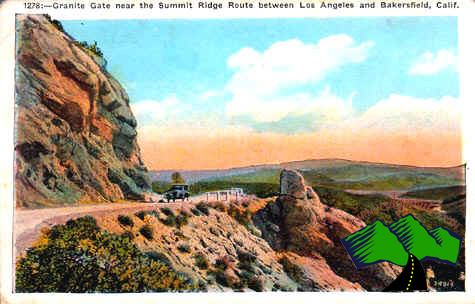
Breaking, Paving,
Residents, Tourists,
Kelly's, Conclusion
Early
Exploration by Europeans
The
first white man through this area was a Spanish officer and acting
governor of Alta California in 1772, Don Pedro Fages. He noticed
an abundance of Cimarron grapes growing wild in the area north of
what is now Gorman. He named the place Canada de Las Uvas, or Grapevine
Canyon. Grapevines were so prevalent the wagoneers and soldiers
had to hack their way through. Wild grapes still grow on the sides
of I-5 in the pass.
Another association of the name Grapevine was established during
early highway construction. The engineers had to abandon the original
wagon road up the canyon from the valley floor when Grapevine Creek
overflowed during a torrential cloudburst in 1914. The highway
alignment was rebuilt on the east side of the hill with a series
of switchback loops to gain elevation. Thus the appearance of a
grapevine.
The name Tejon originated during an expedition in 1806 from the
Santa Barbara Mission into the San Joaquin Valley led by Lieutenant
Francis Ruiz. His diarist, Father Jose Maria Zalvidea, first recorded
the word Tejon to designate the area. A dead badger (tejon
in Spanish) had been found in the canyon.
The name Tejon formerly belonged to another pass 15 miles further
east. Lieutenant Robert Stockton Williamson of the Pacific Railroad
surveyed the area in 1853. His party crossed the Tehachapis by "one
of the worst roads he ever saw." Hearing of a better road further
west, he scouted it and found it would be far more practicable for
wagons if the bulk of the traffic henceforth went that way. The
name Tejon was transferred west to today's "Tejon Pass."
Fort Tejon was established August 10, 1854 as part of General Edward
Fitzgerald Beale's recommendation to provide protection for the
Indians in the area. During it's active years the fort was a center
of social activity.
Beale was the Commissioner of Indian Affairs for California and
Nevada, and later in life, Surveyor-General for both states. He
was called upon to survey the stage route through the Tehachapis
and for his work was rewarded with a huge piece of Kern County territory,
approximately 300,000 acres which today comprises the Tejon Ranch."'It
was the Tejon route via San Francisquito Canyon that the Butterfield
Overland Stage took on its journey to San Francisco from Tipton,
Missouri. At that time, Tipton was the farthest extension of the
railroad west of St. Louis.
The stage fare between Los Angeles and Fort Tejon near the top of
the Grapevine was $12.24 The first mail stage from St. Louis stopped
at Fort Tejon on October 8, 1858 en route to San Francisco. With
the outbreak of the Civil War, the U.S. government abandoned Fort
Tejon, in 1864.
click here for next page
|